Sunday, 10 July 2016

Tour Divide 2016 - Montana


Montana is huge, the 4th largest of all the States of the USA, and this is reflected in the amount of time the Tour Divide spends in the "Big Sky" state.

The border guards let me into the USA after a quick glance at my passport and asked how I was doing. I told them that my knee was giving me problems and they asked how I was going to cope - after all I was only 2 days into a ride that was probably going to take 20 days. I had no idea how I was going to deal with my knee, but my first objective was to get to Eureka where I could find a bed and some food.

Welcome to "Big Sky Country"

The ride to Eureka was mostly flat, but there was a strong headwind so I struggled. I arrived at the Ksanka Inn feeling a bit sorry for myself and checked in even though it was still early and there was plenty of daylight left. I got some dinner and bought a bag of ice to put on my knee.

After a slightly disrupted night of sleep (I woke to find the ice had melted and the bed was wet) I got back on the bike hoping that the rest and ice would have helped my knee. The pain was bad and started to be unbearable within a couple of miles. I had to change something, or else quit.

I found a wall to sit down on and adjusted the angle of the cleat on my shoe. I was pretty sure this wouldn't help as the shoes and cleat position had been fine for the last year. When I started riding again the knee was still sore, but the pain was bearable now, so I carried on.


On the next climb I caught up with three other riders including Dan Golob. We chatted away up the next climb, which was great for taking my mind off the pain in my knee. It seemed that the pain was actually subsiding quite a bit and I was able to put a reasonable amount of power down.

Dan Golob with the mountains of the Glacier National Park behind

After crossing the pass at Red Meadow Lake the trail led downhill to the town of Whitefish. As I rolled into Whitefish I kept my eyes open for other riders who had stopped to get food. Sure enough I quickly spotted Greg May and Hughie Harvey outside a shop and dived in to grab some food. This gave me a big morale boost, as I was worried that my knee would have meant that I had lost touch with lots of other riders I had seen the previous day.

From Whitefish there was a long section of fairly flat dirt and tarmac roads, and I passed a few riders on here. As I reached Ferndale I started looking out for somewhere I could get dinner. I stopped to ask a local who told me where there was a pub and a shop slightly off route. Greg May rolled up just as I was about to head to the pub, so we went to check it out together.

The Rocky Mountain Roadhouse appeared to have fallen through a time warp from the 1980's but the locals seemed friendly. We ordered food and beer while a couple of regulars came over to investigate these strange looking cyclists. Sonny and Kelly were real characters and although slightly worse for wear both were in generous spirits. Kelly dispensed pearls of wisdom "never trust anyone" while Sonny handed me $20. I found it very awkward to accept this gift from Sonny who had a few minutes earlier been telling us that he lived in a caravan in the woods. The $20 paid for most of our dinner and we headed on to the shop where things only got stranger.

As we were doing our shopping we noticed there was a guy walking around with a squirrel on his arm. He explained that the squirrel had been born blind, so he had raised it and looked after it. Bizarre - especially in a shop with ammunition on the shelves - most customers of this country shop would probably shoot squirrels as vermin.

Blind pet squirrel. Ammunition on the shelves above the owner's shoulder.

It was heading towards bedtime and we rode over the next hill searching for a suitable bivvy site. Eventually we rolled into a junction with some flat grassy verges on the trail and noticed there were already three people sleeping there, so we quietly bedded down.

Bright moonlight at the bivvy spot

The next morning involved a huge climb over Richmond peak, but this was rewarded with amazing views of the Rattlesnake Mountains and then a descent with some fairly nice singletrack. My knee was settling down and felt alright for climbing, but it was now quite painful for standing up, so I didn't enjoy the singletrack descent as much as I should have done.

Richmond Peak singletrack with snow patches

Ovando was the next town on the route. It's maybe a bit generous to describe it as a town - the sign on the way in reads "Pop: about 50 Elev: 4,100 Dogs: more than 100". They are some of the keenest followers of the Tour Divide and a photographer greets pretty much every rider who comes into town. Photos are then posted on internet forums for the dot watchers at home to see. I quickly devoured an ice cream and compared notes with Arthur Kopatsy, a French rider living in San Francisco who was also suffering knee problems and had stopped there to try and recover.

I also got a burger from Trixi's Antler Saloon which I found a rather depressing establishment where the only other customers were ladies sitting on stools nursing cans of light beer while feeding money into the gambling machines.

Climbing the Huckleberry Pass

Back on the route I climbed into the evening light over the Huckleberry Pass and on into Lincoln where I checked into a motel.

The next morning's riding took me over the hills to Helena, capital of Montana where I sheltered from a thunderstorm while I filled up on burgers and chips and met Jose Bermudez, who claimed to be from Texas, but spoke with an English accent - it turned out he had grown up in London.

From here it seemed logical to aim for dinner in a place called Basin, but when I arrived there I was told by a local that the whole town was closed and there was nowhere to get food. I rode on towards Butte - a decent sized town where I was sure I could get a meal late at night.

Moose!

The route followed a stream bed which had been completely turned over by gold miners. I pondered how gold mining is essentially a transfer activity (in economic terms the same as burglary) - because there is more than enough gold already sitting in bank vaults to meet all the needs of the world the only end served by mining it is to enrich those who mine it and reduce the wealth of those who hold stocks of gold. Essentially it's a great waste of resources at huge environmental cost.

When I arrived into the town centre of Butte at 11.30 pm I was upset to find that everything was closed except for an Irish bar which didn't do food. I checked in to the only motel I could find that was still open and ate a couple of bags of crisps from a vending machine.

Next morning I hit the Café at Park & Main for a breakfast which fulfilled all my dreams - a huge heap of hash browns with eggs and bacon followed by a mountain of pancakes. This really set me up for the day of riding which lay ahead. The first hill of the day included a notorious descent called Fleecer Ridge. This is super steep and pretty loose, but doesn't have many corners and is therefore rideable. I rode it and enjoyed it, although there was a sketchy moment with my brakes fading on the final steep pitch.

Blue flowers giving the illusion of a lake near Helena

The Wise River club provided a well timed lunch stop where I caught up with Dave Stowe. We rode side by side up most of the next road climb, with Dave's dry sense of humour keeping me entertained and helping to forget about riding for a little while. The next descent was all on tarmac and very fast, but a cold rain had started to fall, so it wasn't too pleasant.

Dave and I arrived together at the Montana High Country Lodge where Russ greeted us warmly and handed us each a hot cup of coffee. I got my third hot meal of the day here and signed Russ' Tour Divide riders sheet before heading out into the damp evening.

As I reached the bottom of the driveway I saw Luke Bodewes and Dean Anderson coming down the road towards me, so I waited to say hi to them. Luke headed up to the Lodge for refreshments, but Dean skipped it, so we rode on together. The rain soon turned quite hard, so I thought about a place that Russ had mentioned to shelter for the night. Dean was also keen to get out of the weather so we headed for the group use shelter at the Bannack village state park.

The rain persisted for most of the night, so I was very glad to be camped under a giant canopy. Unfortunately the next section involved dirt roads that were notorious for becoming extremely hard going when wet. Dean, Jose and I found ourselves on this rather nasty stretch in the worst possible conditions.

The mud stuck to tyres and clogged up the bike so that the wheels wouldn't go round. My technique for dealing with it was to pick up a piece of sage bush from the side of the trail and use this to scrape the mud off the bike. Some sections were worth trying to ride, some were definitely not and just had to be pushed. After a couple of hours I emerged onto a tarmac road and was very thankful it was over.

Sticky mud

Soon I was back off the tarmac and onto another muddy section. I passed Dean and Jose who were attempting to unclog their bikes and then had to stop and do the same to mine. I pushed for a while and then was able to ride a bit. Every so often I found hope that the mud was coming to an end, but this was quickly dashed as a section even worse than the previous bit was encountered.

Looking back into a beautiful hell. Muddy footprints leading up the pass

The sticky mud road rose up to a pass which I pushed up with huge clods of mud clinging onto my shoes. I cleared the bike tyres at the top hoping that the descent would be rideable - it was, just but soon after the track deteriorated again. Thankfully this proved to be the last section of mud and the road turned into a gravel track that followed a river down a canyon with a tailwind.

Cursed mud nightmare road

The trials of the day were not over yet - the route turned right into the wind for the ride into Lima, making what looked like a simple section on tarmac into another torment.

The diner in Lima was a blessed relief - I don't know what the staff must have thought of the muddy cyclists who fell through the door that afternoon, but we all arrived looking half dead and with big appetites. Here Dave Rooney popped in to introduce himself and explained that he had arrived in Lima at 8 am with hypothermia after attempting the muddy Bannack Road in the rain in the dark. He had to check into a motel to get himself sorted out. The mud had also broken the quick release on his rear wheel by jamming between the seat stay and the tyre, but he had managed to bodge a repair with zip ties.

From Lima on it was a fairly pleasant ride into the evening with a classic "big sky country" sunset. I camped at the pleasant Upper Lakeview campground where I was later joined by a couple of other riders.

Farewell from "Big Sky Country"

The night was beautifully starry, but not as restful as it should have been as I woke up several times shivering. In the morning there was frost on my bivvy bag and I was happy to start riding to warm up and climb to the Red Rock Pass and the state line.

Next section: Idaho and Wyoming

Saturday, 9 July 2016

Tour Divide 2016 - Canadian Section

After some photos and chat in front of the Banff YWCA the ride out to the start commenced. Sarah was waiting at the trailhead for a last goodbye - I stopped for a quick hug and kiss and then set off down the trail.

For a while I was in the middle of a big bunch of riders, but within a few miles this had thinned out. The rain started and set in pretty hard. I stopped to add a waterproof jacket, probably leaving it a little longer than I should have done.

By the time I arrived at the Bolton Trading Post 60 miles in I was cold and soaked. I grabbed a coffee and a microwaved sandwich and put on some more clothes. Then I set off over the Elk Pass which included the first steep uphill push of the ride. After a while the rain eased off and there was a chance to enjoy the scenery.

Some nice downhill cruising was brought to a halt by a section of sticky wet mud. My rear tyre was picking the mud up and lumps of it were landing on my helmet. The mud got worse and my tyre was throwing it into my chain so that the chain derailed repeatedly. I couldn't ride and had to get off and push to the next stream where I used the water to rinse the bike off.

After this I was extremely careful to avoid the wetter patches of the trail and managed to keep myself moving. At one point I saw a couple on the side of the trail who were touring the route and had succumbed to the mud. The chain on one of their bikes had broken multiple times and they couldn't get it to stay together. I wished them luck and pressed on carefully.

Soon I arrived in Elkford, where I washed the mud off my bike at a convenient garage, grabbed some food and carried on over the next hill.

Mountains around Elkford

I hit my first navigational problem - the GPS trail I was using had 10,000 data points, but spread over 4,200 km that's not actually all that many. There was a network of small trails in amongst the forest roads and it didn't seem all that clear which way we should go. I took what turned out to be a dead-end path and had to retrace my steps, wasting a few minutes.

All was well though and I arrived in Sparwood well before closing time at the burger stop. I scoffed a couple of burgers and plenty of fries as it went dark outside and discussed sleeping plans with the other folks who had made it. Most seemed to be heading for a motel as it was raining on and off.

Terex 33-19 "Titan" with my bike looking very small beside it.
I had spotted a (somewhat hard to miss) dumper truck which is supposedly the biggest in the world and decided that underneath it would make a good place to sleep.

I slept pretty well under the Titan, and was in the Tim Horton's coffee shop by 4.30, ready for day two of the ride.

During the next road climb I started to feel pain in my left knee, so I stopped to do some stretches which seemed to help a bit. The day involved a lot of climbing - 3 large passes and my knee started to feel worse the more I rode.

The descent of the first pass was very cold and wet for my feet as the track had been washed out by the river in many places. At one point it seemed like the wet section was over, so I stopped to wring the water out of my socks. This proved a complete waste of time as five minutes later I was splashing through another deep river crossing.

Yes, that's the trail. You just have to share it with the river.

The next pass came and went and then the trail took a turn off the forest road onto some interesting looking singletrack. This led to the famous "wall" section which involves a mandatory push/carry for a few hundred metres.

The start of the "wall". Bloody steep! Up you go!

I met Jacqui Bernardi here who had just discovered that 3 of the 4 bolts holding her chainring in place had fallen out on the trail and was going back to look for them. Unsurprisingly she didn't find them. I heard later that she managed to borrow a bolt from another rider and managed to ride for another day to the nearest bike shop with just two bolts and some zip ties holding her chainring in place.

On the final ascent I struggled upwards with my knee feeling like it was full of shards of glass. I knew the top of the climb was not far away, so I kept going and finally made it there. A 1,000m descent followed which felt like bliss by comparison, and this led to the road and a few miles later the Roosville border checkpoint and the United States.

Next section: Montana

Tour Divide 2016 - Summary


4,351 km (2,704 miles)

49,608 m height gain (162,756 feet)

18 days 15 hours 51 minutes


That was hard! Really hard.

Every one of those 19 days on the trail was tough in itself. All of them were well over 100 miles, the longest was over 200 miles. The height gain is the real killer though - the biggest day for height gain was over 4,000m (13,400 feet).

Taken together with no rest days this amount of riding is brutal.

At the end of day two I was in serious trouble with knee pain and thought I might have to quit. Fortunately I made some changes on the morning of day three which made the pain bearable. After that it steadily improved. From then on I felt stronger as the ride went on and never felt that I was in serious danger of not finishing.

Saddle sores, foot pain, hand numbness. These are the long distance cyclist's almost inevitable complaints. They became more or less tolerable at various points, but never threatened to stop me.

I lost a lot of weight in the first week. After that I made a real effort to eat plenty and never passed up an opportunity of a proper meal. Also it became much warmer so my body didn't need to burn as much energy keeping warm. My weight stabilised and from then on I felt like I was stronger than the other riders who were doing a similar pace to me.

The weather varied from cold rain (not quite snow) to desert heat. I slept under beautiful starry skies and awoke with frost on my bivvy bag.

I watched the sun rise and set almost every day of the ride - so many beautiful moments.

The seasons changed from late spring in the north to high summer in the south, and the days grew shorter as I moved towards the equator. The moon moved from first quarter through full and ended as a waning crescent.

Parts on the bike which started out new gradually wore out. Fortunately the only bits I had to replace were the brake pads, and those only once. The tyres, chain and cassette were all toast by the end of the ride though.

Finishing was an amazing feeling - some slight sadness that it was all over, but most of all relief that I would not have to get up and ride a bike the next day!

Here are the links to descriptions of the different sections of the ride for those who are interested in the detail (or just looking at the pretty pictures).

Part 1 - Canadian Section
Part 2 - Montana
Part 3 - Idaho and Wyoming
Part 4 - Colorado
Part 5 - New Mexico

Tour Divide 2016 Kit

Wednesday, 20 April 2016

Kidnapped! Trail April 2016

Kidnapped!

I recently re-read R.L. Stevenson's book Kidnapped, which tells the story of how a young Scots lad is taken to sea under duress and makes his way back to Edinburgh after the ship carrying him founders on rocks near to the Isle of Mull.

I was curious as to the route he would have taken, and started looking at some maps to get a bit more detail than that given on the map shown in the book. The idea then occurred that this could be a great route to do by bike - even if getting to the start might be a bit awkward.

A plan was made, a date was set and a fellow adventurer, Nick was signed up.

Map from R.L.Stevenson's book
As it turned out the plans I had  made for getting to the start by train proved unnecessary as Sarah and Nick's other half Mary were both keen for a trip to Mull and happy to drive back. This also meant that full on bikepacking style - how I had originally envisaged completing the trip would not be necessary and we wouldn't have to carry sleeping kit.

Sunset over Mull from the ferry
Sarah and I drove up from Edinburgh on a Thursday evening and caught the last boat from Oban to Craignure, sailing into the sunset. We then completed the long drive  down the single track road on the Ross of Mull to Fionnphort where we met Nick and Mary at the Fidden farm campsite - a beautiful spot on the beach.

After we had set up the tent I went for a wonder to the tidal island of Erraid – this is where David Balfour, the protagonist from Kidnapped is washed ashore after the shipwreck. Low tide was to be at midnight, so I set off at about 10 to cross the sands to the island. Once I got there I propped up my bike and got my camera out to take a picture of the starry sky. Then I noticed that there seemed to be fingers of light shining up from the horizon. There were no man made lights in view, so I quickly realised that this must be the aurora borealis.


Aurora from Erraid
I caught a couple of pictures before rushing back to the campsite to check that Sarah had seen this too. She had, but by the time I was back the sky had clouded over and the aurora had all but disappeared.


Day 1


Next morning Nick and I commenced the route, with a long stretch of tarmac to begin with. Soon we were pushing our bikes up the slopes of Ben More, following a dashed line on the OS 1:50,000 map which barely existed on the ground. This led to very wet feet, and a col called Craig MhicFionnlaidh. From here we descended, mainly riding but sometimes pushing our bikes over rocks and through bogs to Loch Bà where we picked up a good land rover track that led us back onto tarmac where we wrung out our socks before continuing to Fishnish and the ferry to the Morvern peninsula.

The short ferry crossing dropped us off in Lochaline, where we continued briefly on tarmac past the impressive Ardtornish house and then up a good track to reach Loch Teàrnait and the Leacraithnaich bothy which was in good shape and looked like a nice spot to spend a night. From here the track deteriorated to either a tricky to ride singletrack or a pathless bog. We spotted a badger out hunting in broad daylight near an abandoned croft. The trail eventually brought us to Glen Sanda and a tricky descent to the sea and the enormous super-quarry.

We marvelled at the huge machinery and scars on the landscape as we skirted the quarry on a good land rover track that followed the coast. As we left the quarry we abruptly dropped onto a coastal singletrack. From the OS map it’s normally impossible to know what a trail will be like. I had no information about this costal singletrack apart from a dotted line on the map. It turned out that the trail involved some pushing (or very arduous riding) over shingle on the beach, some rock climbing along the cliffs where we couldn’t get round the costal promontories and some squelching through bogs and being snared by brambles. It would have been harder still if the tide had been in – we would have been forced to climb over more outcrops on the rugged hillside.

Eventually we popped out onto the very scenic road at Kingairloch and the remaining 15 easy miles to the Corran ferry, passing a flock of feral goats grazing on the way. The short (and free for pedestrians and cyclists!) ferry brought us to the busy A82 which brought us to Ballachuilish where we finished for the night.

Ready to go on day 2


Day 2


It rained all night, and was still raining in the morning. In fact it had snowed down to about 500m above sea level, so the mountains were looking impressive where we could see them above the clouds. We elected not to start with the route up Glen Duror and down to Ballachuilish that I had originally planned. The day was going to be long enough without this hilly, and – I expected – boggy start.

Nick climbing up the Chiarain path

We followed the road to Kinlochleven and by the time we arrived the rain had stopped. We stocked up at the Co-Op and then set off up the Chiarain path, climbing on mostly good singletrack past the Blackwater dam and then on to the bothy at Loch Chiarain. As we climbed the cloud lifted and the sun came out revealing the stunningly white peaks of the Aonach Eagach to the south.


Tom near the Blackwater Dam


Looking at the north side of the Aonach Eagach
After the bothy the trail became more technical. Most of it was close to the limits of what I was able to ride, with occasional peaty puddles that sometimes turned out to be only a few inches deep and sometimes threatened to throw us over the handlebars. The trail got worse as we descended to Loch Treig, so it was with great relief that we emerged onto the good land rover track here. By this time I had realised that our progress was not what I had originally anticipated and started to think about modifying our route, so after we climbed to Loch Ossian we deviated away from the planned route which would have taken us over the Bealach Cumhann to Loch Ericht.


Buchaille Etive Mor and the Black Mount across Rannoch Moor
Instead we climbed on a track which was labelled on the map as “The Road to the Isles” which took us past Corrour Old Lodge and then down to Loch Eigheach near Rannoch station. This diversion must have saved us a couple of hours compared to my original route, but missed out a visit to Ben Alder Cottage which is one of the possible locations of “Cluny’s Cage” where David Balfour and his companion Alan “Breck” Stewart stay in the book. The route did offer a spectacular panorama, with Buchaille Etive Mor visible across the Blackwater Reservoir as well as Ben Nevis and the Grey Corries with a fresh coating of snow on the summits.

Nick with the Grey Corries
The rest of the day’s riding was on good tracks and roads, but involved a fair bit of climbing. First we went over the Lairig Ghallabhaich to get from Loch Rannoch to Glen Lyon and then on tarmac over the Lairig an Lochain to descend to Loch Tay and Killin. From here we followed the cycle path to Balquhidder, where Sarah and Mary were waiting at the Mhor 84 hotel having booked us in for dinner.

Day 3


There was frost on the tent for the start of day 3, but it soon warmed up as we rode down the glen – a quick stop to pick up a bacon roll and a bridie at Mhor Bread in Callander keeping the fuel levels topped up. We took bike paths, tracks and back roads through Doune, Dunblane, Alva, Dollar and Dunfermline before eventually emerging at the Firth of Forth.

Spectators on the side of the trail
David Balfour had to take a boat over the Forth, but we were able to roll across the Forth Road Bridge. Soon we were in Cramond for the “official” finish of the route. Sarah and Mary were waiting to meet us and pack our weary bodies and mucky bikes into the vehicles to take us home.

Thursday, 10 September 2015

Mountain bike tour of Mont Blanc

Back in September 2013 I spent a fantastic weekend riding the tour of Mont Blanc. I made a video of it at the time (https://vimeo.com/75344691) but didn't get round to documenting it on here so thought I should put my thoughts and details of the route down before I forgot them.

This is a really special route. It visits three countries (France, Italy and Switzerland) as well as circumnavigating the highest mountain in western Europe. It crosses remote alpages and passes of up to 2,500m. A bike tour should not be undertaken lightly as riding it is both physically strenuous and technically difficult. I would not recommend attempting the route in July or August as the number of walkers on the route can be enormous. June is normally ok for an attempt on the route, however there may be large snow patches to cross, which can be dangerous - I have experienced sliding out of control down one of these with a bike and it's pretty scary! September is probably the best month for it, but a dry October or even November could be good if the snows have yet to arrive.

Being lucky enough to be living and working in Chamonix means I had the opportunity to do this kind of thing on a weekend when other folks would have to plan a whole holiday around it.

I left work in Chamonix at 5 on a Friday afternoon and pedalled like crazy to get to the Prarion cable car in Les Houches before it closed at 5.30. Fortunately I made it in time and 7 minutes later had gone from 1,000m above sea level to around 1,800m. This was the only lift I took on the tour and it didn't feel like cheating as I've pushed up the slope beneath the lift to get up here before and don't feel there is anything to be gained from it. I also had an annual lift pass so the lift was free!
The view from the top of the Prarion lift above Les Houches
The first part of the descent is a lovely singletrack through the pine trees and across the alpine meadows. Lower down the trail turns to 4x4 track before dropping you into Bionnassay. From here I followed the road to the Pont des Places where the track deteriorated into a muddy logging track. A short distance along this I came across the loggers who were scratching their heads over an upturned logging vehicle with its wheels in the air. Not a good one to have to deal with or explain to the boss at 7pm on a Friday!

These guys were having a significantly worse Friday evening than me!

I trundled on to le Champel and then on to the main road to les Contamines before getting onto the bike track that took me all the way to Notre Dame de la Gorge. From here there was a steep climb which involved some pushing, even on a bike with plenty of gears. This led over the ancient Pont Romain and the torrent in its carved out gorge and then past the Nant Borrant refuge where some hikers were enjoying an evening beer. After crossing some meadows I reached la Balme where there is a designated bivouac area. The rules state that it's ok to stay here from dusk until dawn but not to camp for more than one night. This suited me perfectly and there was no one else around.
A cup of tea before bedtime
I brewed some tea and then my pasta dinner followed by more tea. As I drank my final cup of tea before bedtime I noticed that there was a fox stalking me - when I turned my headtorch towards it the fox ducked behind a boulder. It tried several different angles of attack before giving up.

The next morning I woke early and noted a little ice on my bivvy bag as I put the kettle on. This was a reminder that even in September frosts are common at 1,700m. I hadn't been cold in the night though as I was wearing thermals and wrapped in a decent down sleeping bag.

I was on the trail early, mostly pushing and doing a little carrying to reach my first target of the Col du Bonhomme. From here I had imagined that climb to the Col de la Croix du Bonhomme might be mostly rideable as it was only sloping gently upwards. This didn't turn out to be the case as it is strewn with boulders and the path is somewhat indistinct in places.
Col du Bonhomme first thing in the morning
The descent from the Croix du Bonhomme was excellent however. There were a couple of tiny snow patches to cross, but mostly the trail was in fine dry condition. I passed some walkers with their luggage on the back of mules here - 19th century style!

The descent brought me to les Chapieux and a road climb to the Mottets refuge where the ascent of the Col de la Seigne began in earnest. The first part of this climb was rideable (just) with an ok surface and steep gradient. Once my legs were cooked I was happy enough to push most of the rest of the climb.
Col de la Seigne
The descent from here was superb again with a fairly mellow start followed by more loose rock further down. The descent drops you into Val Veny - surely one of the most beautiful valleys in the alps. The incredible peak of the Aiguille Noire de Peuterey sticks out from the south ridge of Mont Blanc and the Miage glacier flows down into the valley.


Looking down into Val Veny
Soon it was time to start climbing again. While it would be easy to continue down the valley to Courmayeur from here I had read that the trails leading through the col Chécrouit were worth the extra climb. This also meant I would be sticking to the TMB walking route. The climb went on longer than I had expected, and was mostly too steep to ride. Being the third major climb of the day my legs were not too keen on so much hard work.
Val Veny
I reached the top very sweaty and got stuck in to the singletrack descent. This was fun and rewarding until I passed the Maison Vielle refuge which is in the heart of the Courmayeur ski area. From here there was a little more singletrack, then I found myself on a 4x4 track which is a piste in the winter. I turned off this down a steppy path which was not ideal for riding. I was a little disappointed with this part of the descent as I didn't feel I had got value for the large amount of height lost. Maybe I didn't find the best way down.

I grabbed a sandwich, some crisps and cake in Courmayeur and then continued up the road into Val Ferret. The walking TMB route goes over the hill from Courmayeur via the Bertone refuge, but from reading about other mountain bike attempts it seemed that this was not a popular biking route, so I had decided to skip this extra climb and follow the road.

As the day was starting to cool with evening approaching there was a strong catabatic wind blowing down the valley, so I was riding up the road into a headwind. Not the best finish to a great day on the bike, but by grinding on into it I managed to get to the perfect spot to attack the Grand Col Ferret first thing in the morning. I stopped just beyond the road end and set my bivvy up amongst some trees near the river. After cooking my dinner I went for a look at the river which had a picturesque foot bridge.
Almost bedtime on the second night
The next morning began with a ride up the well made 4x4 track to the shuttered-up Elena refuge. From here the path was mostly too steep to ride until the last few hundred metres to reach the Grand Col Ferret. There was some frost remaining up here where the sun had not yet hit the slopes, but the day was already warming up quickly.
Halfway up the very long climb of the Grand Col Ferret
The descent from this col must be one of the best anywhere. It's not particularly technical for most of the descent, but has some scary exposure, flowing singletrack and astounding views. It goes on almost for ever!

From the small town of Issert the climbing begins again, this time up to Champex Lac which is a lovely little town on the edge of  a pretty lake. The trail climbs through the trees passing mushrooms carved out of the tree stumps. Some is rideable, a lot of it is too steep and rooty.

After Champex Lac there is a short, technical rooty descent before the climb to Bovine commences. This is a beast of a climb with very steep sections which were actually difficult to push up without sliding back on the loose surface. The climb finally relents and brings you out to the pasture of Bovine. The farm and buvette were all shuttered up and the cows had made their biannual transhumance to the winter pastures. I stopped for a cereal bar and contemplated the view from this lovely mountainside down to the smoggy industrial Rhone valley.
The alpage of Bovine
A few more minutes of uphill brought me to the high point and the start of a brilliant swoopy, rooty, fun filled trail which took me all the way down to the Col de la Forclaz. This is a trail I am keen to ride again, but the only way to do that is an unsatisfying out-and-back from the Col de la Forclaz or to do the horrible push from Champex. Maybe I'll get round to it somehow.

To descend to Trient I couldn't see any permitted mountain bike route, so to avoid the very busy road I slowly and carefully followed the water-race which leads towards the Glacier du Trient (signed as being forbidden for bikes). From here I took the switch-backs which cross the road and eventually lead to Trient.

The TMB route from here back to Chamonix climbs up to the Col de Balme, then down to Tré le Champ before making its final climb to the Lac Blanc and along the Aiguilles Rouges. The climb from Tré le Champ involves ladders, so I had ruled this out immediately. The Col de Balme is accessible by chairlift from the other side, so I had no desire to push my laden bike up it from this side just for the sake of it.

My route was to follow the road to le Chatelet and then an off-road climb (all rideable) to the Col des Montets. From here it's possible to descend to Montroc off-road and then follow the petit balcon nord back to Chamonix.

I enjoyed the final valley trails to take me home in time for Sunday evening dinner. I arrived at work on Monday morning feeling more like I had had a week of adventures than just a weekend!


Thursday, 4 June 2015

Highland Trail 550 2015

My bike kitted out and ready for the journey to the start in Tyndrum

Prologue

I was having a nightmare. It was day two of the Highland Trail and I was in the middle of the infamous Northern Loop in some of the most remote terrain possible in Scotland. The weather was grim. My rear wheel had chosen this moment to fold and was a mess of bent spokes. The situation was undoubtedly serious.
Then I started to notice there was something wrong with this scenario. The spokes were of the flat blade type - my wheel has round spokes. Some of the spokes seemed to be missing completely. Slowly the realisation dawned that I literally was having a nightmare.
I woke in a cold sweat - it was 5.30 am and 3 and a half hours before the start of the race!

Day 1, 12.45 am

The crescent moon was lighting up the clouds beautifully as I rolled across the wild moorlands. There was only half an hour's riding left to get to the Hydro bothy which was my target for the night. I think of this section as the amphibious track. Every 50 metres there seems to be a giant puddle and some of these are as long as the gaps between them. Some of them are only a few inches deep, but some are right up to the hub of a 29 inch wheel. In spite of all this I was really enjoying being out there riding.
It is not often that you have a sensible explanation for being somewhere like this at this time in the morning, but the Highland Trail seemed to be a great reason for that tonight!

The day's riding had started out in lovely warm conditions. As the pack had thinned out towards the Devil's Staircase some chat was shared with other riders.
I caught up with Andrew Hutcheson on the climb out of Kinlochleven. Andrew had been afflicted with cramp after trying to stick with the scorching pace set by Josh Ibbett. Not easy for any singlespeeder to keep up with a super motivated and strong rider on a geared bike.

Andrew Hutcheson crossing the Abhainn Rath
We soon reached the Abhainn Rath which is the first river crossing and the place where dry feet became a distant memory for the remainder of the race. I could just see Josh and Steve Heading in the distance at this point, probably about half an hour ahead. I opened up a small gap on Andrew as we pushed down the squelchy strath towards Loch Treig.
On the way to Loch Treig - Staoineag bothy in the background
From here it was quite easy going for a while until I reached the Corrieyairack Pass. Here the rain started and that was to be the end of the nice weather for the rest of the race. There was a small snow patch to cross near the top of the pass - a leftover from the heavy snows that Scotland has seen this winter.

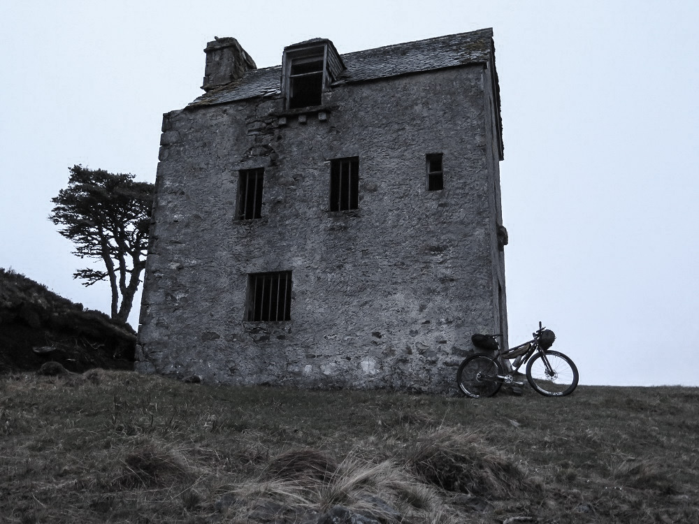
Pizza in Fort Augustus set me up for the rest of the day's riding, up and over past Loch ma Stac where I had a closer inspection of the unusual and slightly spooky ruined tower house than the previous year.
The tower house on Loch Ma Stac
Soon I reached the Corrimony bothy where I had stopped at the end of day one in 2014 and spotted the bikes of Rich and Tom Seipp propped up. Tom is only 10 years old but was having a crack at the Highland Trail route with his dad. It was 10.30 pm which meant I was 45 minutes ahead of where I had been a year previously, so I pushed on into the fading light.

Day 2, 6.00 pm

I staggered forward into the wind up the obscenely steep quad bike track. A gust of wind knocked me back again. I couldn't feel my right hand due to the cold and my left hand wasn't much better. My feet felt like lumps of wood, completely numb.

Progress for the last hour and a half since leaving Glen Golly had been tortuous. The terrain is difficult at the best of times, especially one section which consists of a 19th century stalkers path that long ago fell into disrepair. Add to this wind gusting at gale force, showers of rain and penetrating cold and you have the perfect recipe for a challenging bike ride. This is what the Highland Trail is all about. This is the "Northern Loop" and I was just about to turn south and descend the Bealach Horn. From here on things would have to get easier. Conditions like these would surely result in hypothermia if maintained for more than a couple of hours.

I had woken at 3 am when Josh sneaked out of the bothy. I rolled over and went back to sleep until 4.15 when I started to stir and get ready to ride. The going was fairly easy for the first few hours and I made it to Oykel bridge for 11am in time for my first cooked breakfast of the ride.
Gobernuisgach, a remote outpost in a vast wilderness
All too soon this had led to Gobernuisgach and the entrance to Glen Golly where the truly empty wilderness begins. The land here has no traces of being tamed by man except for the track that the route follows and in places the landscape has repossessed even that.

Near the most northern point of the Trail with Loch Dionard in the distance
Once I had survived the descent of the Bealach Horn I had my sights set on hot food for dinner. In 2014 I arrived at Kylesku at 11.30 pm, far too late for any food. After the beating I had received from the weather I knew that hot food would be a huge morale and energy boost. I pressed on over the hill from Achfary with this in mind and arrived at the pub just before 9. I was delighted to get a table for dinner and a pint of Skye Brewery Blaven ale.

After consuming my gourmet 2 course dinner (puy lentils, monkfish and mussels were involved) I set out with the idea of doing another hour before finishing for the night. In the end I rolled on all the way to Achmelvich where I bivouacked next to the beach at about 1am.

Day 3, 9.00 pm

I stood on the pebble shore of Loch Strath na Sealga and savoured a rare moment of peace and dry weather. The evening sun was shining up the strath through the clouds and I felt relaxed and comfortable. For the first time since the afternoon of day one my clothes were all dry from the ankles up.

Loch Strath na Sealga in the evening sun
The day had begun with a 5 am start and I was soon on the roll into Lochinver. I wasn't feeling good as I set off into Glencanisp and I decided to have a lie down for half an hour at Suilags bothy. I reached the bothy at 6.50 am. I had assumed any occupants would still be in bed, however as I propped up my bike I heard voices and the sounds of breakfast being made. Unable to summon the energy to go in and talk to the bothy dwellers I got back on the bike and kept on riding.
On the way into Glencanisp forest with Suilven in the distance
The trudge through to the Cam Loch did not seem as bad as the previous year. This is a section which you are bound to underestimate unless you are unfortunate enough to have done it before. Soon I was on the road and rolling into the Oykel Bridge Hotel for another big breakfast.

The route through to Ullapool is easy going by Highland Trail standards so it wasn't too long before I found myself filling a basket with food in Tesco while the rain came down outside. As I was stuffing my face with sandwiches and pastries in the warm entrance of Tesco Andrew Hutcheson walked in. He had scratched at Fort Augustus after having back problems to add to his cramp on day one and had driven up from his home in Strathpeffer to see some riders come through. We had a good chat about the Trail before I got back on the road.

After pushing over the steep lump to get to Corrie Hallie I was into Fisherfield and reached Strath na Sealga. I passed the Shenavall bothy without stopping and reached the shores of the loch. The river crossing here was much wider than in 2014 and deeper too. I removed my baggy shorts and waded in - no point in trying to keep my bib tights dry and my shoes and socks were wet to begin with.
The Abhainn Strath na Sealga which I was about to cross and Beinn Dearg Mor
After the thigh deep crossing I stopped at the cottage of Larachantivore and ate my Tesco pasta dinner before pushing on into the fading light to cross the Clach na Frithealaidh and descend to Carnmore bothy arriving just after midnight.

Day 4, 4.00 pm

As I had passed through pubs and cafes on the Trail I had received messages from Josh who was out in the lead. "Josh says see you at the finish" and "Josh was here at 6 am" were a couple of examples. As I crossed the south Torridon hills the rumours became more frequent as a couple of fellow bikers reported sightings of Josh - I knew I wasn't far behind. Having nearly reached the valley at Achnashellach I came to a gate in a fence and spotted Josh just riding away from it.

At first I think his racer instincts made him consider riding off as fast as he could. Then he stopped and said "I think you just made my decision for me". Josh explained that the pivots in his full suspension frame had failed due to the dreadful conditions. He had been trying to nurse the bike round the rest of the route but having been caught by me he realised there was not much point in continuing and potentially doing more damage to the bike.

We chatted for a few minutes as we continued to the train station then shook hands and I carried on. I was disappointed for Josh that he had worked so hard to build a commanding lead and then lost it due to a mechanical.

I had made an error in my stay at Carnmore bothy the previous night. This is a strange bothy as it has actual beds, some of them with mattresses. I picked one of these to roll my sleeping kit out onto and started to blow into my thermarest. After a few breaths I realised this seemed pointless, stopped blowing and got into bed. An hour later I awoke shivering convulsively - the cold, damp mattress was sucking the warmth out of my body with no air in my thermarest to make it insulate. I therefore was not as well rested as I should have been when I stepped out into the rain at 6am that morning having slept through my alarm clock.

The morning had improved after that as I crossed the Tollie path without problems and made it to the Whistle Stop Cafe in Kinlochewe for a good breakfast. I managed to have a chat with my fiancée Sarah on the phone here although I was struggling to talk after I burnt my tongue on a hot piece of fried egg.
Yet another big breakfast - this one at the Whistle Stop café in Kinlochewe
After crossing through Torridon and passing Josh the Trail took me on past Attadale and into Glen Ling where I passed a large number of smelly dead deer - possibly killed by the snowy winter the highlands had recently experienced.
Eilean Donan castle and Loch Duich
Arriving in Dornie I tried to get a table in the Clachan pub but they were full up, so I had to go to the Dornie Hotel instead. The food here was not as good as the Clachan and the beer selection was dire - Guinness or lager - I opted for a pint of coke. While eating dinner I checked Twitter to see what was happening in the race. I was shocked to see that Steve Heading had scratched. Steve is a rock solid bike racer who had pursued me doggedly round the route in 2014. We had both ended up at the Clachan for dinner then and Steve had told me he had worked hard all day just to ensure that he made it to the pub before closing time. I speculated that the thought of having to achieve the same day's riding again this year in harder conditions might have wrecked his motivation to continue.

I was finding the knowledge of my 2014 times both a motivator and a source of disappointment. I had arrived for dinner in Dornie an hour ahead of my 2014 time, but my overnight stops were far shorter than the previous year. I should have been a few hours up but I was frustratingly only one hour up.
Ascending the Allt Grannda, 10:30 pm
With this in mind I rejected the idea of stopping for the night at the Camban bothy which comes at the top of the climb past the Allt Grannda waterfalls and pressed on down Glen Affric and into the endless forests around Tomich. Finally at 3 am I decided to have a sleep on the side of the track before tackling the hills that lead to Fort Augustus.

Day 5, 8.00 am

I had reached Fort Augustus too early to get a proper cafe breakfast, but the butchers shop was able to provide a bacon and Lorn sausage roll and a cup of sugary coffee. This was essential sustenance to get me down the Great Glen to Fort William and I enjoyed munching this while standing in the butchers shop.

The wind had been strong for the whole of the race so far and it showed no signs of letting up as I rode into it down the Caledonian Canal. What should have been an easy spin was an energy sapping grind.

I felt the need for more hot food in Fort William, so I stopped for lunch knowing my nearest competitor was in the same location where I had been at 7 pm the night before. This food and rest stoked me up for the final 6 hours of the ride down the West Highland Way. It hardly stopped raining for the whole of this time so I was soaked to the skin and chilled to the bone by the time I finally hit Tyndrum.
One of us was soaked and freezing, not sure which one. (Photo Sarah Autie)
My fiancée Sarah was waiting at the finish for a big hug under an umbrella and Alan Goldmith's friend Sarah was there to take finishers photos too. After that I had to go straight to the campsite showers to warm up before getting some dry clothes on.

After some dinner we bumped into Josh and went for a couple of pints at the pub to exchange stories from the Trail. Josh was already starting to plan for the 2016 Highland Trail having learned a lot from his attempt this year. He mentioned that not wrecking his body on the Highland Trail was important as he will be starting the Transcontinental Race in July. Returning as a veteran is a massive advantage for any challenger.

I was not expecting when I set off to ride the Highland Trail to be the first one back to Tyndrum. There were four of us from those who set off who looked to have the right kind of pace and sleep/lack of sleep strategy to win. It was unfortunate that the other three were taken out by the main trio of factors the Highland trail will tend to throw at you. The physical had taken out Andrew on day one, while on day 4 the mechanical had done for Josh and the mental for Steve. As the sole survivor of this bunch the race was mine to lose from then on.

I must emphasise how much harder it was in 2015 than 2014. I finished 26 minutes faster this year. In 2014 I spent around 22.5 hours stopped overnight in total compared to 15.5 hours this year. So I spent 6.5 hours more on the move in 2015. This was due to a combination of the cold, wet, windy weather and damp ground conditions both making the riding slower and also meaning that spending time in warm pubs and cafes recovering was more of a necessity than a luxury.

I think I'll take a break from the Highland Trail in 2016 and look for new adventures elsewhere.

Statistics

Times are from starting riding to stopping for the night, so include café and pub stops

Day 1: 237km 16 hours 15 minutes
Day 2: 216km 20 hours 15 minutes
Day 3: 139km 19 hours
Day 4: 164km 21 hours
Day 5: 147km 14 hours 20 minutes

Total distance 906km
Total time 90 hours 50 minutes

Kit list

Shand Cycles custom steel frame
Salsa CroMoto rigid steel fork
29" wheels, 2.2" tyres
Singlespeed drivetrain (chainring and sprocket have done the HT550 twice!)
Garmin Edge 800 GPS (ran out of power and repeatedly crashed)
SP PD8 dynamo hub
Tout Terrain Plug III dynamo to USB power converter (allows charging above 14km/h)
Belkin USB power pack and USB cable to charge GPS
Exposure Revo front light
Cateye rear light
Alpkit Yak harness and drybag on handlebars
Alpkit Possum frame bag
Revelate Designs Viscacha seat pack
Rab Neutrino 250 sleeping bag
Thermarest NeoAir ground mat
Terra Nova bivvy bag
Embers Merino long sleeve jersey for riding and long sleeve base layer for sleeping
Thermal long-johns for sleeping
Assos bib shorts and bib longs
Norrona baggy shorts
Giordana warm long sleeve layer
Specialized Rime shoes
Gore Bike Wear waterproof jacket
Endura thermo merino socks
Dakine Traverse gloves
Specialized Vice helmet
Tools: Park Tools multi tool, Gerber multi tool, tubeless repair kit, pump, spoke key and chain tool
First aid kit
Canon G16 camera
Compass, whistle, paper maps printed at 50% on A5 paper in Ortlieb waterproof map case
Mobile phone, cash and credit cards
Petzl tikka xp headtorch
Toothbrush and toothpaste
2 x 500ml drink bottles.